FEMA Flood Zone Determination
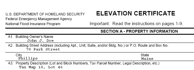
Maine Boundary Consultants has all of the equipment and knowledge to complete FEMA Elevation Certificates and/or Letter of Map Amendment Applications. Elevations Certificates are required to obtain Flood Insurance and or to prove that Flood Insurance is not necessary for your dwellings. A Letter of Map Amendment is necessary to remove a portion, a structure or all of the property from a FEMA designated Flood Zone.
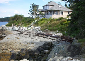
These services can be very valuable to property owners who have been told by their lender that their home or place of business is located within a Special Flood Hazard Zone according to the FEMA issued Flood Maps and must purchase separate flood insurance. Unfortunately when Flood Insurance Rate Maps were created by FEMA there was very little attention to detail and more often than not the indicted Flood Hazard Zones covered much more area than any flood would inundate.
Our services would include making a site visit to determine certain elevations in and around the building in question, for example; the basement floor elevation, first floor elevation, and lowest grade elevation adjacent to the building. We would then compare these elevations and other data with the Base Flood Elevation, which is the maximum elevation that the flood waters would reach in a so-called “100 year flood” event. If it is found that the building is below the Base Flood Elevation, then it is indeed within a Flood Zone and flood insurance is necessary. The Elevation Certificate is still necessary to determine the cost of the flood insurance. If we find that the building is above the Base Flood Elevation, and out of the Flood Hazard Zone, we will submit an application requesting a Letter of Map Amendment to FEMA. Once this application is reviewed by FEMA the structure will be granted a Letter of Map Amendment which will remove the building from the Flood Zone and negate the necessity to purchase Flood Insurance saving the owner hundreds of dollars a year.